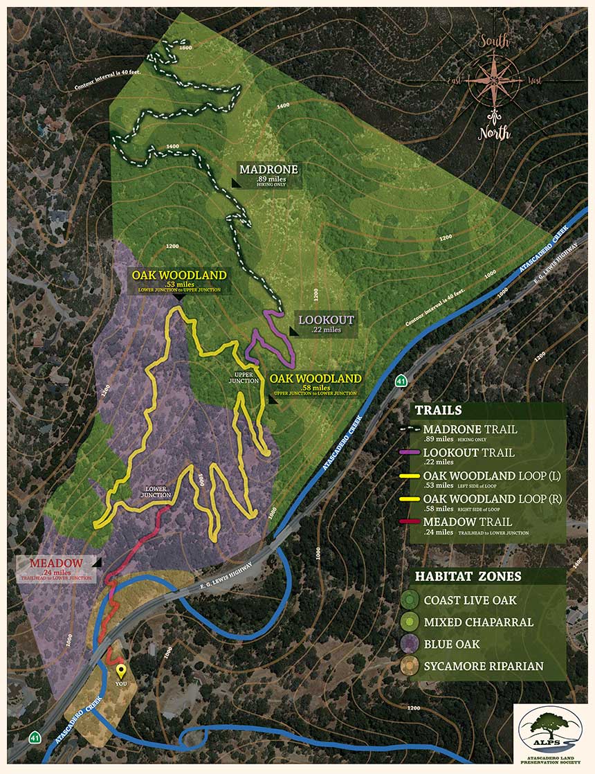
Trail System
The three-mile trail system consists of both multiuse (hikers, equestrians, bicyclists) and hiker-only sections. The system begins at the 940’ elevation trailhead on the Meadow Trail across Atascadero Creek and up to the Oak Woodland Loop Trail. These two trails together create a loop trail (up and back) approximately two miles long in the lower half of the Preserve. The trail takes one through a mixed riparian habitat, a grassland meadow, and up through oak woodland populated by several different species of native California oak trees including blue oak and coastal live oak. Located on the eastern-facing slope of the property this loop trail will provide a shaded woodland hike that will be accessible and available for all ages of hikers, including children and seniors. This loop trail will be multi-use and available to hikers, cyclists, and equestrians.
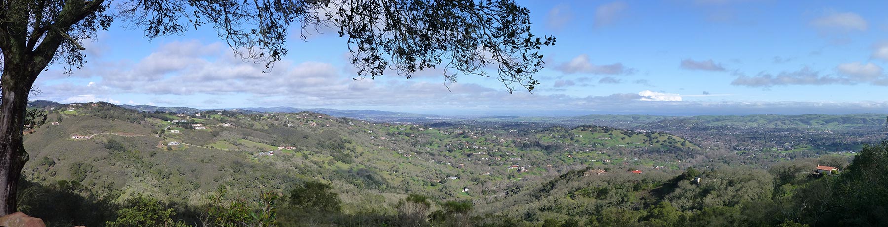
Continuing off the Loop Trail, the Lookout Trail gains elevation out of the mixed forest into chaparral ending at a scenic overlook at 1250’ elevation. The overlook affords views of the City of Atascadero and the rural hillsides that encompass the City Center. The Lookout trail is multiuse, but land and soil conditions beyond this point combine to make a trail suitable for hikers only. Tie ups for horses and bicyclists will be available for those who want to hike up to the top of the Preserve on the Madrone Trail.
The Madrone Trail continues past the 1250’ vista through mixed flora to the highest elevation on the Preserve. Gaining in elevation, hikers will discover small groves of madrone trees, uncommon within Atascadero city limits. Between the madrones, oaks, and tall ceonothus hikers will often be in the shade, a welcome relief during a summer hike. Toward the top of the trail, hikers will encounter dense stands of manzanita before arriving at the trail end at 1620’ elevation. A shaded rocky vista point rewards hikers to sit and enjoy a sweeping view of northern San Luis Obispo County. The up and back distance from the trailhead to the 1620’ elevation point is 3.8 miles.
Click on the following map to download a PDF version: